Clearer labels
Centroids
There's so much buzzing around my head right now, and to be honest I'm not too sure where to focus my time. I've started all this slightly out of the blue, and it's quickly exploded into such a wide variety of topics, all of which I'm really interested in, but simply haven't got the time to explore fully all in one go. I guess to a point that's ok, as I will dabble in lots of topics, and those I most enjoy will naturally bubble to the surface.
Right now, I think it's important that I get to know QGIS better...
QGIS is a powerful, GIS (Geographic Information System) software that allows users to create, edit, visualise, and analyse all types of geospatial data. Because it is completely free and open-source, it provides an accessible platform for mapping, spatial analysis, and database management without the high licensing costs of commercial alternatives (ArcGIS).
The platform supports a vast range of data formats, including vector layers, raster images, meshes, and 3D point clouds. Due to its open community approach, QGIS features a massive plugin ecosystem, built by its users, that allows users to easily customise and extend its core capabilities.
You may have seen in my first few Projects that I jumped straight in to a few random ideas without really knowing the software. I just had a couple of thoughts and followed some web tutorials to get the results.
Nothing wrong with that, it's a common way to start, and I learnt a few things along the way. But it did leave me feeling like I needed to get to grips with the basics.
QGIS does have a certification scheme - great, I like the official tick. But as with all things it comes with a cost, and i'm trying to keep costs to a minimum. Also i'm trying to separate what is really necessary and what isn't. Right now paying to get certification doesn't seem justifiable. There are short courses around that take just a couple of days to complete, but they cost at least a couple of hundred quid.
As there is such a wide and open community there are lots of other options to learn, including YouTube videos, forums, and of course now AI is helping (a lot).
There is also a pretty good online manual by QGIS that walks through a lot of the basics, so that was for me the best place to spend some time.
It was quite nice going through the basics, and the exercises which come across as a little too basic, are actually very helpful for understanding the fundamentals.
Just realising some of the capabilities has made me rethink the first couple of projects that I attempted.
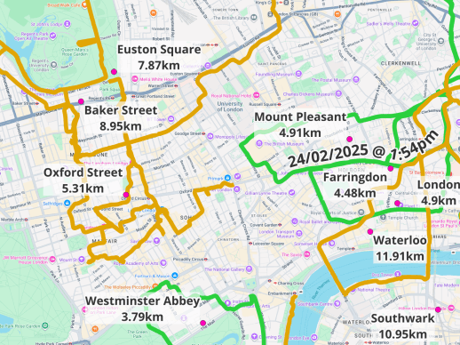
During Project 1 I combined all of my Apple Watch fitness routes onto one map, so that I could see an overview of where I had walked around the country. It worked ok, and I got a basic overview maps. But now I know about some extra features I've gone back and had another go.
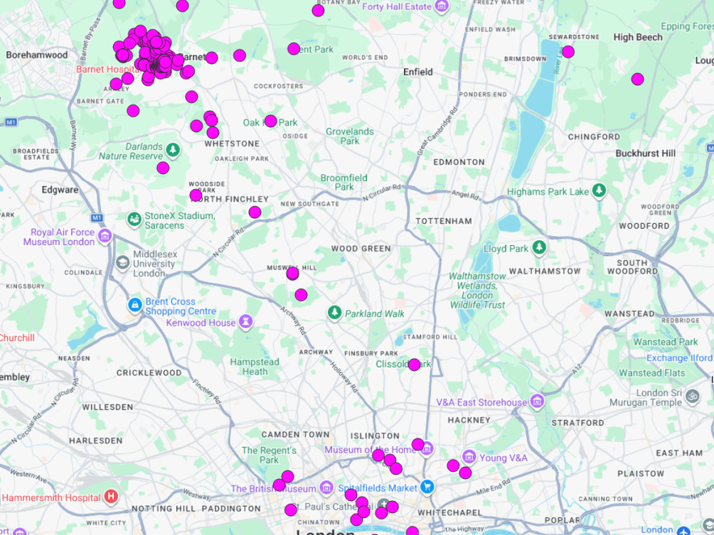
I liked the idea of generating the centroid of each route, and there is a simple function for that which generates a point. Taking this point to the next level I imported a text database of UK place names (with coordinates) and then used a function to locate the nearest town to the centroid point and associate the town's name to each point. This meant that the town could then be added as a label on the map.
Also, the routes are very congested on the map, and i'd discovered visibility related to scale. It's an interesting concept, and now I can control which routes appear and when. So when zoomed out at a large scale, only the longest routes appear, and when zooming in those disappear and the shorter routes come in to view. Combining visibility and town labels has made the map much clearer!
Clearer labels
Centroids

AI Website Generator